Koh Chang Thailand Guide 2026: Beaches, Ferry & Rainy Season
Koh Chang (also written Ko Chang) is a large, mountainous island in Trat province near Thailand’s Cambodian border. Its combination of forested hills, beaches, waterfalls, fishing communities and small-island excursions makes it a rewarding destination beyond the more familiar resort hubs. However, the island receives heavy monsoon rain, and older guides can give outdated ferry information. This 2026 guide prioritizes practical travel decisions and current operator context over guarantees of perfect conditions.
If you are comparing coastal destinations, our Thailand beach seasons guide explains why Ko Chang’s best months differ from the lower Gulf islands described in our Ko Samui guide.
Koh Chang at a glance
- Region: Trat province, eastern Thailand, close to the Cambodian border.
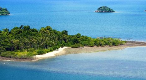
- Main attraction: rainforest hills, beaches and the Mu Ko Chang National Park archipelago.
- More favorable weather: approximately November–April for many outdoor and boat activities, with dry-season variation each year.
- Arrival: mainland Trat ferry pier followed by a car ferry to Ko Chang; there is no standard passenger airport on the island.
- Getting around: shared pickup taxis or rented vehicles where legally licensed and appropriate to road conditions.
- Stay: at least two or three nights to explore beyond one beach.
The Tourism Authority of Thailand Trat guide identifies the national park and waterfalls and notes rougher sea conditions during the wet season. For another eastern-coast holiday reachable overland from Bangkok, compare Pattaya, which is a different urban beach environment.
Best areas to stay on Koh Chang
White Sand Beach
Hat Sai Khao is a well-known entry-level resort area with easier access to restaurants, shops and transport. Travelers who prefer a wide selection of accommodation may start here, though its developed environment can feel busy in peak season. Confirm how far a hotel is from the actual beach rather than relying on a generic Ko Chang address.
Klong Prao and Kai Bae
These west-coast areas provide a mix of beaches, restaurants and quieter lodging. They work well for couples or visitors who want to spend more time on the sand without the intensity of the busiest strip. Beach conditions change with rain, wind and tides.
Lonely Beach and southern communities
Lonely Beach attracts independent travelers, but not every property is a party hostel. Farther south, Bang Bao’s fishing-village setting is useful for boat-tour departures. Do not assume a cross-island road is flat or easy to drive: several hill sections are steep and potentially slippery after rain.
Natural activities and island excursions
Waterfalls and forest walks
Klong Plu and Than Mayom are among the island’s best-known waterfalls. Swimming access, national park admission and the safety of steps or trails can change after heavy rainfall. Check the local park office before hiking, avoid entering water near dangerous currents and do not venture behind barriers for photographs.
Snorkeling around nearby islands
Boat tours may visit marine areas around Koh Rang and smaller islands when operating conditions permit. Ask operators about conservation restrictions, weather cancellations, life jackets and snorkeling supervision. Coral protection is especially important: do not stand on reefs or feed fish.
Responsible wildlife experiences
Koh Chang’s name means Elephant Island, but that does not make elephant riding an environmentally responsible attraction. Choose wildlife activities that prioritize animal welfare and avoid venues selling performances, coercive handling or rides. Forest and birdlife sightings are never guaranteed, and wildlife should be observed quietly at a distance.
How to get to Koh Chang from Bangkok
By bus or private transfer to Trat
Overland travel from Bangkok to the Trat coast commonly takes several hours, with the total affected by traffic, operator and the exact ferry departure. Some bus services run toward Trat or Laem Ngop, but you may need an onward local vehicle to reach the active ferry pier. Confirm the endpoint and last departure before buying a separate connection. If you want to break the drive with another destination, Hua Hin is in a completely different direction and is best planned as an alternative coastal route, not a direct stop on the Trat road.
Important 2026 ferry update
Ferry Koh Chang continues using the Ao Thammachat mainland terminal for crossings to the island. An October 2026 local ferry information service reports regular operations around 06:30–18:30, with departures affected by passenger demand and ticket purchases at the pier. It also reports that Trat Ferry, formerly Centrepoint Ferry, suspended service in July 2024 and had not resumed. Treat that as an operator report and recheck the day before travel rather than following the original article’s instruction to use either ferry interchangeably.
Current conditions and fare changes are summarized by Koh Chang Ferries’ October 2026 timetable bulletin. Weather can disrupt crossings even if the posted timetable appears normal.
When to visit: dry season versus monsoon
Much of Trat’s annual rain falls from about May through October, with very heavy conditions possible during midyear months. November through April is generally a better window for beaches and marine tours. During wet spells, waterfalls may become more dramatic but trekking conditions can deteriorate; rain can also make motorbike riding unusually risky on the island’s steep roads.
Check Thailand’s weather agency before hiking or boarding a boat. Island resorts sometimes remain open through the monsoon but individual tour companies and routes may operate limited schedules. Travelers seeking more dependable weather elsewhere should compare seasonal patterns in Phuket or Krabi rather than assuming the same month works equally well on both coasts.
Three-day Koh Chang itinerary
Day 1: beaches and a gentle first afternoon
Arrive by ferry early enough for an unhurried transfer, check in on the west coast and walk to a nearby beach. Avoid committing to a remote sunset viewpoint on unfamiliar roads after dark.
Day 2: forest and local culture
If trails are open and conditions suitable, visit a waterfall in the morning. Spend the afternoon in a village or quiet bay. Respect local communities by asking permission for photographs and choosing businesses with clear environmental practices.
Day 3: boat tour or flexible beach day
Take a licensed snorkeling trip only if marine conditions allow. Otherwise enjoy a slow beach day and arrange the return ferry well before onward flights. If your main interest is island scenery elsewhere in Thailand, read Ko Phi Phi as a different itinerary choice rather than an easy day trip from Koh Chang.
FAQs
Is Koh Chang good for backpackers?
Yes. There is a range of accommodation and beach areas, but transport prices and the steep terrain are worth factoring into your budget.
Can I drive a motorcycle there?
Only if you hold the appropriate legal license and are experienced with steep, sometimes wet roads. Visitors who are not confident should use local transport.
When is Koh Chang’s rainy season?
Approximately May to October, with year-to-year variation and a high risk of strong monsoon rainfall.
Is Centrepoint ferry currently operating?
October 2026 operator information says the former Centrepoint/Trat Ferry route remained suspended; confirm the active crossing before departure.
References
- Tourism Authority of Thailand: Trat and Mu Ko Chang National Park
- Koh Chang ferry operators and October 2026 timetable information
- Thai Meteorological Department
Originally posted 2025-11-24 19:17:49.